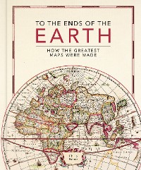
To the Ends of the Earth
Philip Parker
* Affiliate Links
Links on findyourbook.com are so-called affiliate links. If you click on such an affiliate link and buy via this link, findyourbook.com receives a commission from the respective online shop or provider. For you, the price doesn't change.
Geisteswissenschaften, Kunst, Musik / Geschichte
Description
This lavishly illustrated book provides a unique insight into the evolution of mapmaking and the science behind it, from the stone age to the digital age.
Britain’s leading cartographic author takes us on a historical journey through how the greatest maps were created. Exploring
key cartographers and mapmaking methods, as well as fascinating interludes on subjects such as the very first maps, deliberate mistakes, and superlative maps, this comprehensive guide explores how the
techniques and technology have developed throughout human history:
•
Evolving methods of surveying: from the Roman groma, through the naval instruments of the magnetic compass, astrolabes and sextants, to the 20th century revolution of aerial photography
•
Drawing tools and materials: from Babylonian maps carved in clay, to digital maps created via touchscreen
• The introduction of
various mapping conventions and
key components of a map: from Ptolemy's introduction of longitude and latitude, through the 13th century origins of having north at the top, to the various projections used to represent the Earth.
With
visually stunning historic maps and antique instruments, this book will engross readers with its fascinating stories of how we came to chart our world.
customer reviews
oceania, projections, compass, Theatrum Orbis Terrarum, adventurer, christopher columbus, maps that changed the world, military, conquistadores, wind rose, woodcut, islamic, vasco da gama, cartographers, commerce, nonfiction, cassini, cartography, south america, maps, surveying, dividers, engraving, dutch empire, historic maps, navigation instruments, latitude, interesting, spanish empire, voyage, africa, asia, old maps, travel, longitude, astrolabe, gerardus mercator, globe, present, groma, cuneiform wedges, illustrated, mapmaking, lithography, portolan, john speed, world, book of maps, journeys, fra mauro, explorer, sextant, emmanuel bowen, japan, north america, gift for, merchant, geography, history, atlas,atlases, matthew paris, Map, copperplate, mappae mundi, rhumb lines, factual, papyrus, british empire, military mapping, vesconte, klencke atlas, naval, Nuzi map, longditude, pictorial, ptolemy, babylonian map of the world, global


